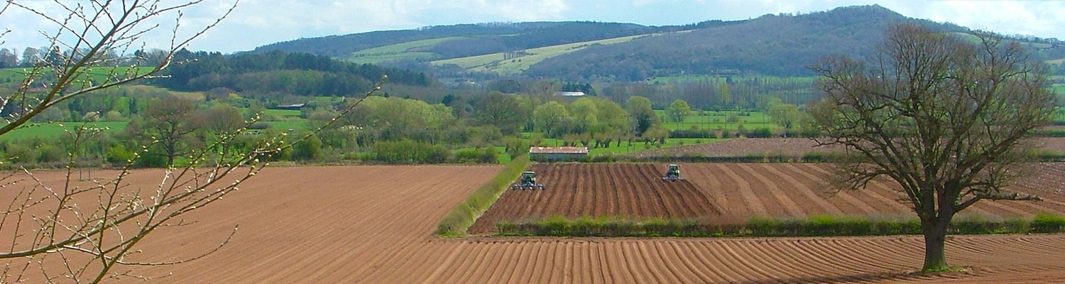
What counts as agricultural land?
Agricultural land is land that is suitable for agricultural production for both crops and livestock. Agricultural land is split into two different categories arable land and pasture land.
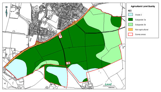
Agricultural Land Classification (ALC) is a system used in England and Wales to grade the quality of land for agricultural use, according to the extent by which physical or chemical characteristics impose long-term limitations. It is used to inform planning decisions affecting greenfield sites. The system classifies land into five grades:
Grade 1 - excellent quality agricultural land with no or very minor limitations.
Grade 2 - very good quality agricultural land with minor limitations which affect crop yield, cultivations or harvesting.
Subgrade 3a – good quality agricultural land with moderate limitations that affect the choice of crop, timing and type of cultivation/harvesting or level of yield. This land can produce moderate to high yields of a narrow range of crops or moderate yields of a wide range of crops.
Subgrade 3b – moderate quality agricultural land with strong limitations that affect the choice of crop, timing and type of cultivation/harvesting or level of yield. This land produces moderate yields of a narrow range of crops, low yields of a wide range of crops and high yields of grass.
Grade 4 – poor quality agricultural land with severe limitations which significantly restrict the range and level of yield of crops.
Grade 5 - very poor quality agricultural land with very severe limitations which restrict use to permanent pasture or rough grazing with the exception of occasional pioneer forage crops.
Grades 1, 2 and subgrade 3a are considered within the ‘best and most versatile’ land category in the current planning system. This land is deemed the most flexible, productive and efficient in response to inputs, it is the best to deliver future crops for food and non-food uses (such as biomass, fibres and pharmaceuticals).
If you’re developing agricultural land...probably!
The National Planning Policy Framework (paragraph 170) requires planning authorities to "recognise the economic and other benefits of the best and most versatile agricultural land” when making decisions on development proposals.
The policy is relevant to all planning applications, including on smaller land parcels, although it is for the planning authority to decide how significant the agricultural land issues are and the need for information. Natural England/Welsh Government are the statutory consultees. Applications for mineral working or waste disposal are also required to produce an ALC where agricultural land is to be affected.
In order to grade the land, a desk based study and field survey are required to assess the factors that affect the site and their interactions. The main factors affecting land grade are:
Following the survey, a report is issued to the client that covers the following:
Our reports and associated maps are professionally produced to the format required by the statutory authorities, helping to reduce consultation delays when determining planning applications.
As a distinguished provider of agricultural land classification services, we place a significant emphasis on the meticulous process of agricultural soil sampling. This critical procedure involves the systematic collection of soil samples from various depths and locations within a parcel of land, ensuring a comprehensive analysis of soil health, fertility, and structure.
By employing advanced techniques and state-of-the-art equipment, we are able to accurately assess the suitability of land for agricultural purposes, guiding land use planning and management decisions. This approach not only enhances agricultural productivity but also contributes to sustainable land management practices, underpinning Land Research Associates' commitment to excellence in serving the agricultural community.
If you wish to discuss ALC requirements, please contact us on +44 (0)1509 670570 or email info@lra.co.uk

Agricultural land is land that is suitable for agricultural production for both crops and livestock. Agricultural land is split into two different categories arable land and pasture land.
There are some areas where you can build on agricultural land with many hoping to turn it into a development plot and return on investment. You will need to apply for planning permission before you even start and there are many aspects you will need to consider. Talk to a land researcher who will talk you through the land and its properties.