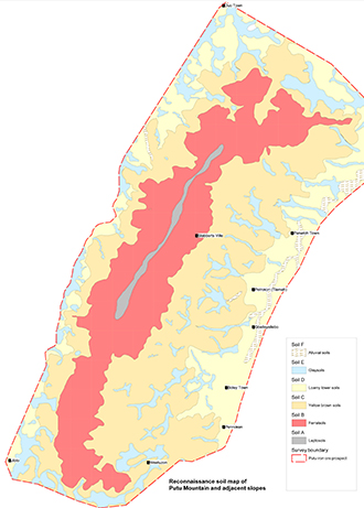
Soil Survey and Soil Mapping
A detailed knowledge of soil distribution and characteristics is essential to make informed decisions about land use and protecting soil from damage. Our soil scientists have many decades of soil survey experience from the UK, Europe, Africa and Australasia in:
- Detailed, semi-detailed and reconnaissance soil survey
- Presentation of survey results in multi-layer map form using MapInfo and ArcGIS
- Soil pedological description, sampling and interpretation of analytical results
- Classification according to US Taxonomy, World Reference Base 2006 and national systems
- Providing training in soil survey and characterisation

Soil Resource Surveys
Typical applications of soil resource surveys include:
- Mine, quarry and landfill planning and restoration (click here for further information and case studies)
- Soil management plans for construction projects (click here for further information and case studies)
- Agricultural land classification (click here for further information and case studies)
- Forestry and woodland creation and management (click here for further information and case studies)
A good soil resource survey will, for example:
- Delineate and provide descriptions of the different soil types including the thickness and characteristics of the surface and subsurface layers within each type, and the results of laboratory analyses
- Identify any areas of soil that could be suffering contamination and consequently requiring further investigation
- Assess the suitability of the different soil resources for re-use on or off site (e.g. as BS 3882 Topsoil or BS8901 Subsoil), matching soil types to landscaping requirements
- Detail good practice on soil handling, management and the remediation of any soil damage (e.g. compaction) caused during site working
This flow chart itemises the stages that a comprehensive soil management plan should include.
For further information contact us on +44 (0)1509 670570 or email mike.palmer@lra.co.uk
Frequently Asked Questions
Who uses a soil survey?
A soil survey is commonly used by the public and the scientific community. Farmers and ranchers can use it to discover if their soil is suitable for crops and livestock and what element of soil management might be involved. An engineer might use it to find out if the soil is right for construction and a homeowner may even use it for basic garden constructions.
What are the types of soil survey?
There are three types of soil surveys: detailed, reconnaissance and detailed reconnaissance.
What are the three main parts of a soil survey?
Detailed Soil Survey: soil boundaries are plotted accurately on maps on a basis of observations made throughout a surveyed area. Detailed soil surveys are important as they provide the information needed for planning land use and management.
Reconnaissance Survey: soil boundaries are plotted from observations made at intervals.
Detailed Reconnaissance Survey: using both the detailed and the reconnaissance
What are the principles of soil survey?
Applying the principles of soil science and draws heavily from geomorphology, soil formation theories, physical geography, and analysis of vegetation and land-use patterns.
Who uses a soil survey?
Anyone can use a soil survey but it is commonly used by farmland owners or potential home buyers. Anyone can request a soil survey. Get in touch to find out more.
Will there be any damage to the land or crops?
The survey is carried out on foot using hand tools, all hand dug trial pits are back-filled and carried out on tramlines/field margins where possible. The survey causes minimal damage to crops.


